
[Smart City Today]
The Ministry of Land, Infrastructure and Transport (Minister Won Hee-ryong) announced that it will actively cooperate in providing 3D spatial information and upgrading prediction models for the success of the digital twin-based AI (artificial intelligence) flood forecast pilot project promoted by the Ministry of Environment.
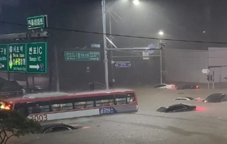
Previously, the Ministry of Environment announced in August that it would implement a digital twin-linked AI flood forecasting system for the Dorimcheon (Sillim-dong, Seoul) watershed, which is a torrential rain area, by announcing measures to prevent flooding and river flooding. The Ministry of Land, Infrastructure and Transport decided that high-precision spatial information such as three-dimensional terrain, building three-dimensional model, and sewer line is essential for accurate prediction model construction, and consulted with the Ministry of Environment on the utilization of spatial information under construction or collection and management.
Three-dimensional spatial information used for digital twin construction includes a digital elevation model (1m), orthoimage (12cm), and three-dimensional building information (LOD4). In particular, detailed information on the sewer network constructed in the underground spatial integration map is needed for comprehensive analysis of rainfall as well as drainage discharge. To this end, the Ministry of Land, Infrastructure and Transport will provide the three-dimensional spatial information to the Ministry of Environment first, and the spatial information that needs to be updated with the latest data will be provided through the renewal work within the year.
In addition to providing three-dimensional spatial information, they will look for ways to utilize spatial information to build an effective forecasting model between the two ministries.
For this, a seminar will be held on October 18 to discuss ways to utilize digital twin spatial information, such as sharing examples of existing projects and consulting experts.
Kang Joo-yeop, director of the Ministry of Land, Infrastructure and Transport said “I hope that the tragedy caused by flood damage will be stopped through smooth cooperation between the ministries and agencies, and by expanding the scope of digital twin spatial information, I will continue to find projects that can help. "


![[토큰경제학] 엔비디아의 다음 돈줄은 GPU가 아니라 메모리다](https://cdn.www.smarttoday.co.kr/w400/q85/article-images/2026-06-10/b8779f99-0e61-4370-ab4d-d84e450ee10e.jpg)

댓글 (0)
댓글 작성
댓글을 작성하려면 로그인이 필요합니다.
로그인하기